Glorious woods, hidden valleys, a huge view of the weald over the top of Churchill’s house. Another Greensand Ridge classic with similarities to Leith Hill walks in Surrey (and Ide Hill and One Tree Hill on this site). No direct train option, unless you use Sevenoaks or Oxted stations and take a taxi, but if you have a car it’s not far out of town, just beyond Biggin Hill. There is a half-hourly bus service from Bromley North and South stations and Hayes station (the 246). There are similar versions of this walk in many books so it’s a popular area for a stroll. Close to the Ide Hill walk – so could do one walk before lunch. This walk takes 2-3 hours depending on pace. Distances stated are ball park. Park in Westerham (pay car park off Quebec Avenue) or for a shorter version (take a mile and a half off the total) park at Hosey Common Car Park (free) and follow my Walk 21 route.
Distance from SE London: 40 min drive from Sydenham
View walk as a pdf, download and print out
Public Transport
Take bus 246 to Westerham from Bromley or Hayes station and join the walk from the alley with the stone steps towards the eastern end of the high street in Westerham, opposite the green. Use the GPX map (link below) to pinpoint your location. Other public transport options include train to Oxted then taxi (or infrequent Southdown bus 594/595) or train to Sevenoaks and taxi (or hourly Arriva bus 401).
The walk in detail
See GPX map at Ordnance Survey to find real time location (click on bottom right compass icon to find current location). Also, if you prefer, view GPX version at AllTrails.
Point 1-2 350 metres Park in Westerham in the car park off Quebec Avenue (pay Mon-Sat). Make for the churchyard just beyond the car park. Walk up and past the graves and church and emerge on to Westerham Green. Cross the Green and cross the A25 from next to the bus shelter and traffic island and look for the stone steps up to a little alley opposite.
Point 2-3 500 metres Walk down this old alleyway crossing the infant River Darent, emerging after 100 metres or so on an open grassy (and often incredibly muddy) space. Turn right (west) and walk for 200 or so metres parallel with the river until you reach Mill Lane
Point 3-4 500 metres At Mill Lane turn left and walk past parking spaces and a house. By the house the path splits into two. The left hand path goes along the valley floor alongside the Darent, a lovely path too. The path we are taking, however, is the one straight on, uphill. Continue to the top of the hill, admiring the views (this is Squerry’s Park Common.) After about 500 metres, shortly after passing through a clump of trees, you reach a path junction.
Point 4-5 2km Turn left at this junction After 250 metres, still walking generally south, cross another path junction (which occurs at a point with a long meadow on the right) and continue straight on, over a stile, with trees again on your right and the River Darent, now a little stream, hidden on your left. After about 300 metres you pass another long meadow on the right, this time with an isolated and slightly spooky looking house at the far end (Hunters Lodge, pictured below). After passing this meadow you go through a metal gate and keep to path on left (ignore path going right) to pass behind two more houses (The Coach House and Crockham House) and then walk past amazing beech trees that are fused together on a path that looks like something out of Game of Thrones. Continue for 600 metres, passing a field on your right near Gardener’s Cottage, as the path begins to bend left (more easterly) and comes uphill on to the somewhat dangerous Hosey Common Rd.
Point 5-6 1km At the road look for the path up Mariners Hill nearly opposite (still in woods). Cross with care, the road is a magnet for bad driving I’ve found. Continue uphill through the woods; keep the bridlepath on your left; our route doesn’t take the main path – we’re using the path on the right, which soon runs next to a garden fence. Beyond the fence is a large house (Windmill Bank Cottage) with generous gardens and a superb view. After the house, the path continues through woodland downhill. Soon after this there is a nice side path offering a brilliant view to Tonbridge and beyond from Mariners Hill. About 100 metres after this look out for a path going back uphill on the left (north), which may be signposted Mariners Hill Loop (I didn’t notice the sign last time). This is the turning point of the walk – from now on heading generally north – and one of the best bits. Take this path (Mariners Hill Loop), which soon flattens out and gives a great view over Chartwell House to the Weald beyond. There are giant wellingtonia trees to admire and gorse bushes at this point and a seat or two to admire the view. The loop path after about 350 metres meets the standard Mariners Hill path we left earlier after crossing Hosey Common Road. Turn right (east), down towards Mapleton Rd and the NT Chartwell car park.
Point 6-7 400 metres. Cross Mapleton Rd. You are close to the National Trust cafe here at the far end of the car park. If you don’t need a break continue on the signposted path opposite leading uphill with a fence on the left, passing another spectacular house on the hillside with suitably silly gardens. Back in woodland you reach a quiet lane at the top of the hill called Hosey Common Lane.
Point 7-8 1.5km Cross the lane and take the path opposite through woods signposted back to Westerham. At the first path junction keep left and keep an eye on the Westerham signs to ensure you stay on the most direct path. (If you are not sure – woods can be hard to navigate – then follow paths heading north/north-west and you can’t really go off route.) At the next junction follow the path branching right (I think also signed Westerham) which eventually comes out by the Hosey Common car park (ignore another path branching off to the right). At the car park, with its distinctive old school house, cross Hosey Common Rd.
Point 8-9 1km After crossing look left (south) to rejoin the signposted footpath. The path now briefly heads south again (with more lovely gardens and an old house off to your right) through woods by the road before bending away to head back west then north. Soon you’ll be walking below large conifers. After this, the path emerges from the woods with the conifers on your left. Walk up the steep bank ahead to point 9, for the shortest route back to Westerham.
Point 9-car park 900 metres At the top of the hill you can see Westerham ahead; just go straight on to re-enter the town from the alley. Fab walk.
See similar but shorter route from Hosey Common (Walk 21)

Donations
If you’ve enjoyed one of the walks on this site and feel it’s enriched your day, feel free to make a small donation here if you wish. It'll encourage me to add more walks, update information and work harder to improve accuracy and quality. Thanks a lot.
£3.00
Click here for detailed Ordnance Survey map of the paths

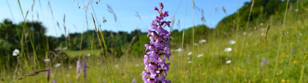
Weald view from Mariners Hill, Kent. Remembrance Day, 2017


