(The blue line on the map indicates the path on Downe Bank where the best bluebells can be seen on this walk in late April. Continue on the blue line path to make a longer circular walk taking in Berry’s Hill; add 1.5 miles – now covered on Walk 20)
As of December 2022 this delightful short walk’s early stages have been slightly spoiled by new fences. These divert walkers around the edges of fields now grazed by sheep (they were previously superb wildflower meadows you could walk across). However, super hedgerows, the chance of seeing second world war Spitfires, beech trees and old, flint and wooden houses and a beautiful church are compensation. Two pubs with decent food. An easy walk, good with children, that passes Charles Darwin’s Down House and gardens. Forty minutes’ drive from East Dulwich, bus 146 from Bromley or Hayes. Covered on Ordnance Survey Explorer 147 map. Easy to extend the walk by following the blue route on the map. If you want to try a longer Downe walk (4 miles) try Walk 20 on this site, or if you have time for another walk, try the Knockholt, Hosey Common or Polhill routes – each within five miles.
Distance from SE London: 30 min drive from Sydenham, approx 45 min from Bromley North on 146 bus
Download a pdf and print out this walk here
GPX map here (for real-time location check). which you can download (snap barcode) or view on phone (press the bottom-most icon on left of screen to get real-time location).
The walk (40mins-1hr/2.6 miles)
Route summary:
Point 1-2 (about 500m): Take the path right just east of Christmas Tree farm on Cudham Rd, passing over a stile (don’t inadvertently take the second path signed to Cudham). Walk south past Christmas Tree farm paddocks with new (as of December 2022 fence on your left). The path turns 90 degrees right, still with the new fence on your left then left (south) again to a corner of another pasture field. Follow this south with the fence still on your left until you hit a tarmac driveway. Here turn left, towards a farmhouse.
Point 2-3 (480m): Ignore another sign pointing to Down House and pass through a metal gate. Look for Stable Cottage sign and walk past it; see ‘footpath’ sign pointing right (south) with a row of cypress trees on your right. Join this path past Downe Court farmhouse crossing over surfaced driveway and passing monkey puzzle tree (follow the yellow marker ahead) and follow edge of field sharp left then right. Arrive at path junction with signposts.
Point 3-4 (450m): Turn right (west) across middle of field heading towards country lane (Luxted Rd) through gap in the hedgerow. At Point 3.5 on my map cross road and enter lovely meadow adjacent to Downe House. Pass between small trees in centre of meadow and reach north-western corner of field where there’s an entrance into the garden of Downe House.
Point 4-5 (180m): Pass the entrance to Darwin’s garden, then pass through a metal gate (crossing the great man’s ‘sandwalk’) and a wooden gate into another lovely meadow with a view of woods ahead of you to the south-west. Cross this field on the path diagonally to the left. Watch out for deer at dusk and owls. The path increasing heads downhill then reaches a hedgerow, goes over a stile, then down steps to a junction with a north-south path and signpost.
Point 5-6 (280m): At this junction turn right (north) and follow the path through light woods to a country lane (West Hill).
Point 6-7 (850m): Cross the lane and continue on the path heading north. Very soon it turns sharply left downhill (west) (ignore metal gate and path on the right) before continuing north and after a few hundred metres emerging in a field with golf club house in valley to left. Continue through two fields admiring beech trees and hawthorn borders.
Point 7-8 (350m): Cross the final field (the third and largest) and enter woods ahead. Watch for a right turn ahead where you will find an opening by a broken down stile into another field to return to the village. (There are two paths that enter these woods, it doesn’t matter which you use but if you choose the lower one then you will have to turn right, doubling back on yourself before just before emerging from the woods; if on the upper one, turn right and enter the field on your right.)
Point 8-9 (650m): Head east on the usually clear path across this field which is muddy in winter, sometimes cereal in summer, sometimes fallow. Aim for far right corner (south-eastern corner) where the path narrows to a kind of alley with holly around and barbed wire fence on left and emerges on to the road into Downe by a bus stop. This field used to be a lovely rewilded meadow, but sadly no longer. What a shame. At road, turn right to go to the Queen’s Head or tea shop.

Donations
If you’ve enjoyed one of the walks on this site and feel it’s enriched your day, feel free to make a small donation here if you wish. It'll encourage me to add more walks, update information and work harder to improve accuracy and quality. Thanks a lot.
£3.00
More detailed route guide:
Get off the bus by the church of St Mary the Virgin (13th century; look out for the graves of Darwin’s family) and walk east past the George and Dragon pub on Cudham Rd. The walk starts with the marked footpath heading south off Cudham Rd just past the cute Christmas Tree Farm. This footpath is signposted to Biggin Hill and Luxted, and is by a brick wall – do not take the footpath signposted to Cudham a bit further on (another fine walk but not now!) (Point 1). Follow the fenced-in path (such a shame, the path beautifully traversed these meadows diagonally until December 2022 but now there are sheep in the fields and walkers are hemmed in on a path around the edges of the fields), with the enclosures of Christmas Tree farm on your right..
The path now takes you south along the edge of another field (you are still hemmed in by the new fence to your left) with a view of Down House to your right across the road. When the path meets a tarmaced drive to a farmhouse, turn left on it towards the farmhouse (Point 2). At the farmhouse, ignore another footpath sign pointing back towards Downe House and continue past the Stable Cottage sign towards the house, skirting it and taking the path that heads south (right) just in front of it (another slightly hidden ‘footpath’ sign guides you) and go past a monkey puzzle tree while walking over a surfaced drive.
Continue around the edge of a field to the left (east) then sharp right (south). At Point 3 take another sharp right (heading west towards Downe House) at the intersection of footpaths (if you were to go left here, you’d soon enter a fantastic bluebell wood, best seen in May of course). Cross the road (Point 3.5) and enter the meadow (brilliant with daisies and buttercups from May to July) bordering Darwin’s house and garden, with small cricket pitch on your left. Continue, through a lovely little arch of small trees in the middle of the field.
The path meets the western corner of Darwin’s garden (Point 4) – you can have a quick peek, but you’ll have to pay if you linger – then head across the great man’s ‘sandwalk’ and diagonally left across another field with a great view of a wooded valley. This is my favourite part of the walk as you look over unbroken treetops to the western horizon for what seems like miles. At dusk, watch out for wild deer at this point. Superb sunset vistas also. Don’t let the occasional waft of kerosene jet fuel from the airfield detract from the timeless vibe of this part of the walk! The path descends slightly into the valley then joins another path (Point 5), this time running north to south. So, turn right here (heading north) and just keep on going through the woods. Biggin Hill airfield is just beyond the trees on the other side of the valley. There is a quiet golf course on the floor of the valley (West Kent Golf Club). After a few minutes you will cross a lane (Point 6) and continue on the footpath heading north. The path suddenly turns left (west) just as it reaches a field beyond the fence and descends sharply for a few metres before bending back right and continuing for a couple of hundred metres through more mature woods to the first of the wildlife-rich hillside fields.
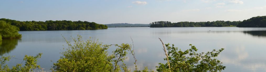
So, now we’ve reached the first of the three hillside fields. You’ll see superb beech trees on your right (amid the occasional old bomb crater from one of many Luftwaffe attacks on the air base in August-September 1940) and the large golf club house across the valley to the left. Look out for deer, especially at dusk. You’ll cross the three fields (the last field, pictured above, is Point 7) on this path before entering woodland and, after about 80 metres, turning 90-degrees right to enter a field (there used to be a stile here but it disappeared in 2017!) (Point 8) and head east across this wheat/corn field aiming for the south-east corner (right-hand corner) until the path becomes narrow with a hedge on the right and you emerge back on to the village road. Until late March 2015 this field was a beautiful wild pasture with flowers and hawthorn trees. The tenant farmers have planted a cereal crop in there – lovely in June but muddy and annoying in winter. Also they have a nasty habit of ploughing it up and obliterating the footpath from time to time. On reaching the road (by a bus stop) turn right and look out for the Queen’s Head (Point 9) just before returning to the church and the village bus stop (Point 10).
Biggin Hill Airport
The extensive woodland on the east side of the airfield, which this walk skirts, is that mentioned by the late Geoffrey Wellum in his astonishing book First Light, covering his time at RAF Biggin Hill as a 19-year-old Spitfire pilot. I cannot recommend this book enough… it’s not a tale of derring-do heroics but a very real record of an uncertain young man thrust into extraordinary circumstances. During the Battle of Britain the airfield was badly damaged by bombing after a burst of intense low and high level raids at the end of August 1940 – not as many lives were lost here as at Detling near Maidstone but there were still over 40 military and civilian fatalities on the ground.
The airfield, whose history began with radio experiments before the First World War, later in the war was host to an incredibly international wing of squadrons including legendary French pilots such as Rene Mouchotte and Pierre Closterman, Belgians such as Vicki Ortmans, New Zealander Al Deere and South African Sailor Malan. The stories surrounding this place are the stuff of legend and yet there is little to be seen that tells the stories of heroism and disaster concentrated in these few acres. The Aircraft Museum in Shoreham might be a good place to visit to get a feel for what happened here.
After the war, squadrons of Gloster Meteor jet fighters and Hawker Hunters were based there until it was decided (in the mid-1950s) that the area was too built up and not suitable for fast jets – a decision made after a couple of fatal crashes in the vicinity.
Today the airport is used mainly by executive jets. In recent years a few Spitfires, a Hurricane or two and assorted vintage aircraft have been based there and are often flown by the Heritage Hangar. Some of the Spitfires have been converted into two-seaters and take passengers up – it’s about £2,750. The airfield has been a famous airshow venue ever since the 1920s – it is the site of the Red Arrows’ first display in the 1960s, and the first base for the Battle of Britain Memorial Flight (1950s). This tradition continues with occasional airshows featuring the Red Arrows and aircraft ranging from 1930s biplanes to modern jet fighters.
Pubs and cafe/deli
The Queen’s Head serves delicious ales such as Harvey’s Sussex Best and choice tipples from nearby Westerham Brewery and if the cider called Rosie’s Pig is on, you’re in for a treat. There’s also the George and Dragon pub just a few metres from the Queen’s Head. The Holwood Farm Shop a popular pitstop for cyclists with its pleasant courtyard and good coffee is on New Rd Hill by the junction with Shire Lane just north of Downe.
Public transport
146 bus from Bromley (20 mins’ duration), or train to Orpington and then R8 bus (15 mins, no Sunday service). You can also get the train to Hayes (on the New Cross/Lewisham/Ladywell/Catford Bridge/Lower Sydenham line) and pick up the 146, or get a cab, or cycle. Hayes is the nearest railway station to Downe.
Pub guide on these walks click here
Another, longer, Downe walk
Great Kent walks, from John Harris’s Walking in England website


Pingback: Winter magic in short supply – Kent walks near London
Pingback: Muddy and miserable – Kent walks near London
Pingback: Golden light at the end of a grey day – Kent walks near London
Pingback: Where’s best for orchids in Kent (but near London)? – Kent walks near London
Pingback: Encounter with a kite – Kent walks near London
Pingback: Woody wildflowers on display before the big blue – Kent walks near London
Pingback: In the depths of springter – Kent walks near London
Pingback: Bats in the mist – dusk at Downe, Keston and Polhill – Kent walks near London
Pingback: The heat is on – escape from SE London? – Kent walks near London
Pingback: Bluebells in north-west Kent: where’s best? – Kent walks near London
Very interesting.
LikeLike
Pingback: All a flutter – Kent walks near London
Pingback: Fears for tiers: Kent a no-go zone – Kent walks near London
Pingback: Get your head in the clouds – Kent walks near London
Pingback: Something to chew on in Cudham – Kent walks near London
Pingback: Christmas and New Year’s walk choices – Kent walks near London
Pingback: Longer Downe route – Kent walks near London
Pingback: Best bluebell walks in north-west Kent 2019 – Kent walks near London
Pingback: Darwin’s fields and Downe – Kent walks near London
Pingback: Find a Kent walk near London that suits you – Kent walks near London
Pingback: Find a north-west Kent walk that suits you – Kent walks near London
Pingback: Exotic trees and crazy mud – Kent walks near London
Pingback: Downe walk – Kent walks near London
Pingback: Biggin Hill airshow – Kent walks near London
Pingback: Bluebells around Shoreham, Ide Hill, Downe, Kent – Kent walks near London
Pingback: Downe in winter snow – Kent walks near London
Pingback: Country pubs on walks around Shoreham, Downe, Sevenoaks, Ide Hill and Hever, Kent – Kent walks near London
Pingback: Getting lost on these walks; who wrote this rubbish! – Kent walks near London
Pingback: A few Downe images – Kent walks near London
Pingback: Airshow at Biggin Hill – as seen from a detour from the Downe walk – Kent walks near London
Pingback: Wild flowers after the bluebells – Kent walks near London
Pingback: May soleil and last chance for bluebells – Kent walks near London
Pingback: A new walk (Hever) and last chance for bluebell walks – Kent walks near London
Pingback: Best bluebells near Shoreham – Kent walks near London
Pingback: Bluebells north west Kent 2016 – Kent walks near London
Pingback: A family walk around Down House | Diary of a Herne Hill mum
Pingback: An early Easter as the meadows and woods wake up – Kent walks near London
Pingback: Christmas holiday walks | Kent walks near London
Pingback: Eight of the best walks in north-west Kent | Kent walks near London
Pingback: So long autumn… hello winter | Kent walks near London
Pingback: Summer’s lease | Kent walks near London
Pingback: Summer dusk walks | Kent walks near London
Pingback: Bluebells | Kent walks near London
Pingback: Big trouble (sort of) in little Downe | Kent walks near London
Pingback: The walks | Kent walks near London